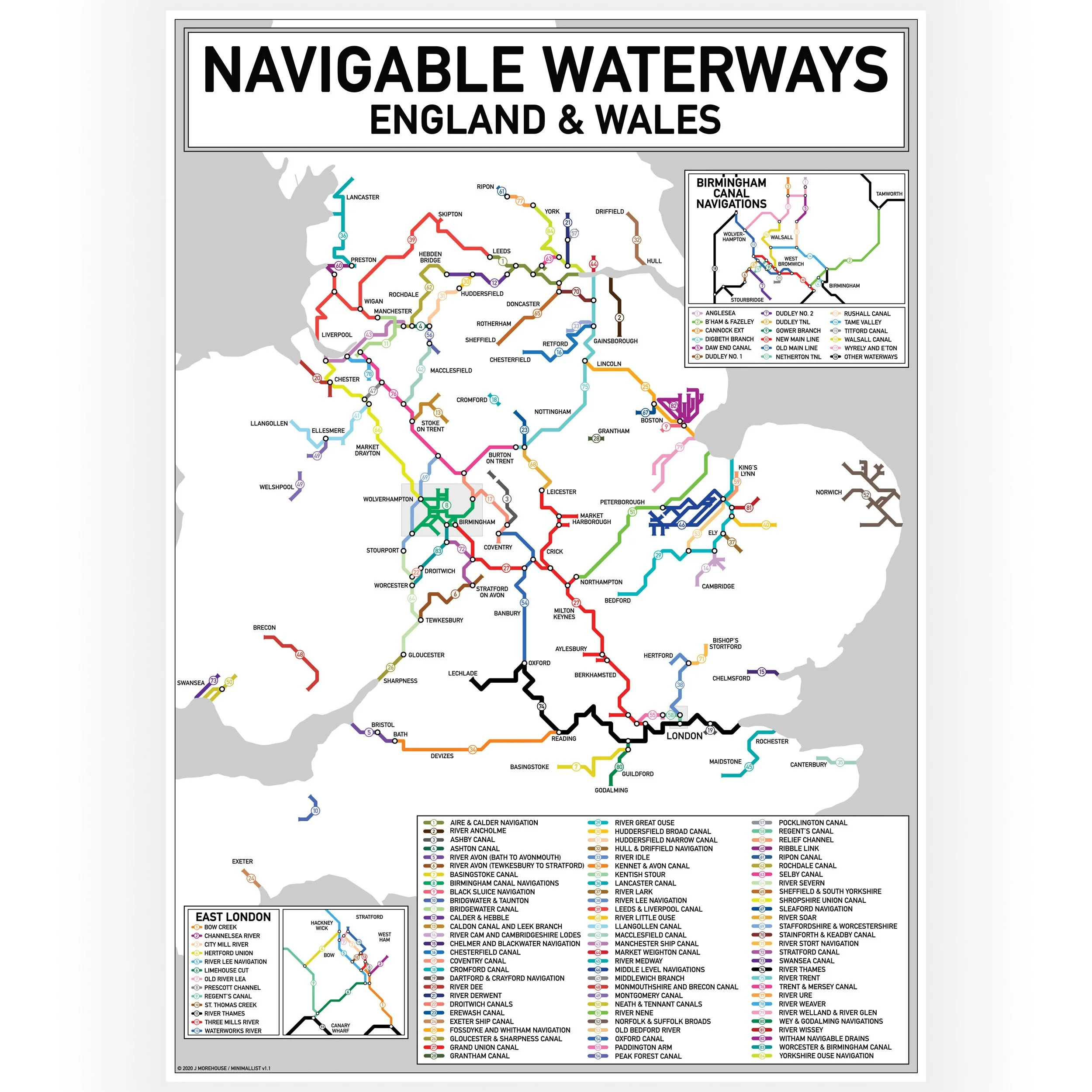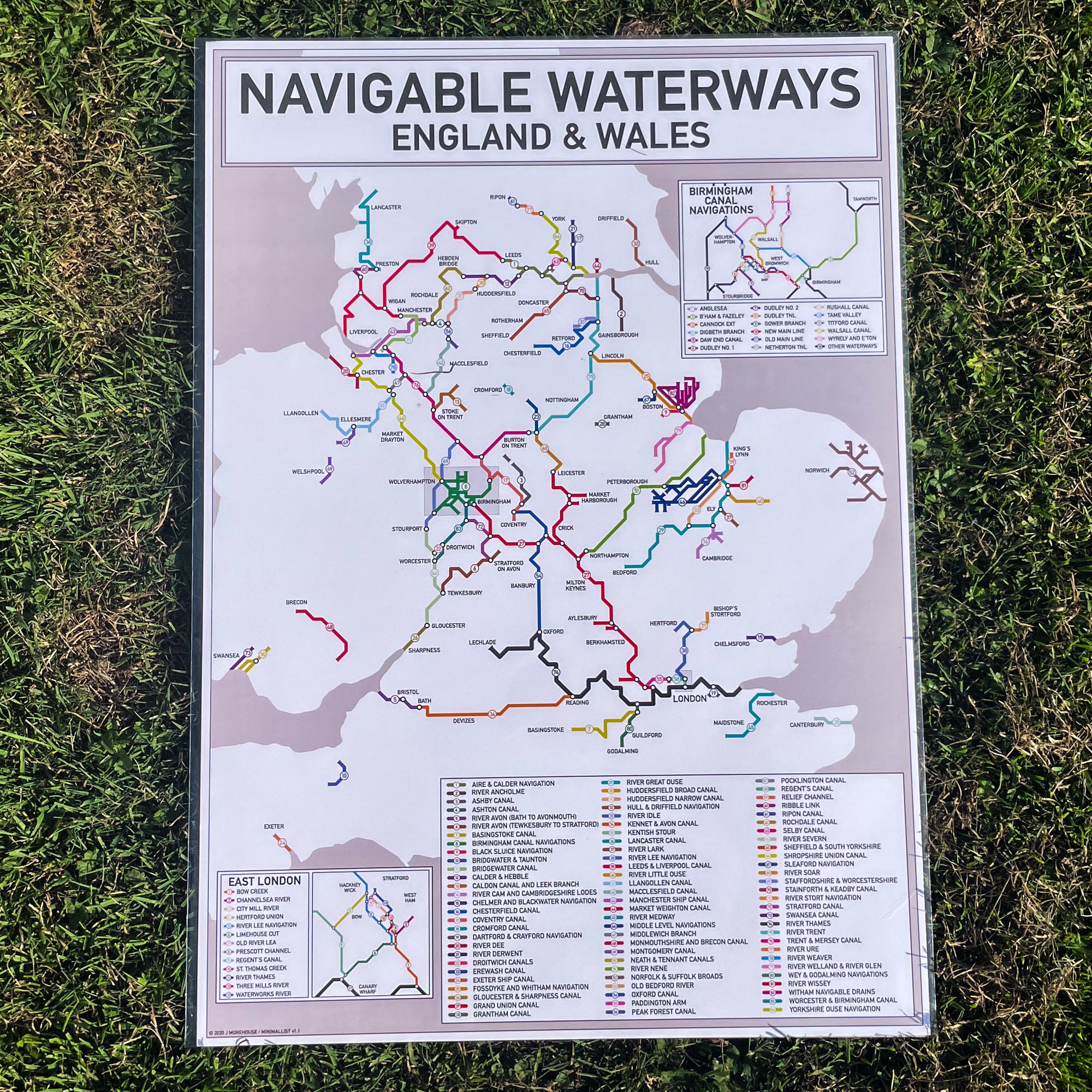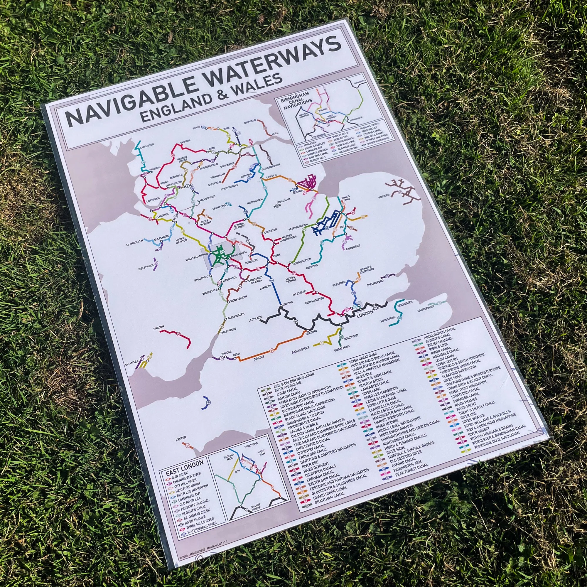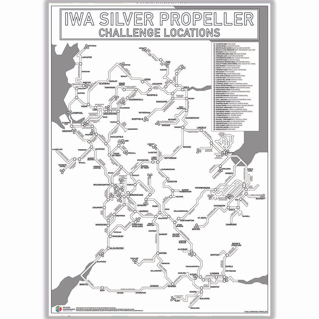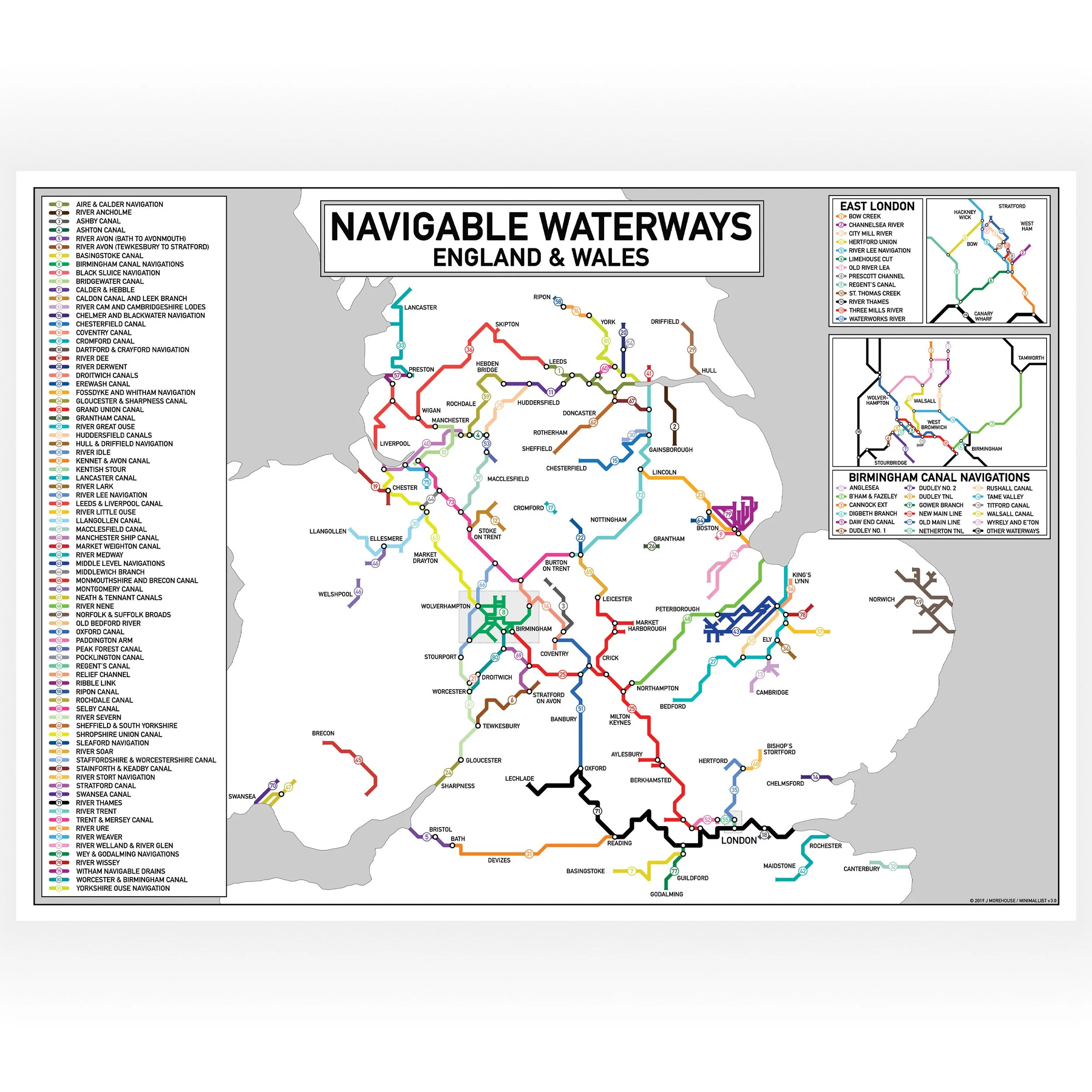
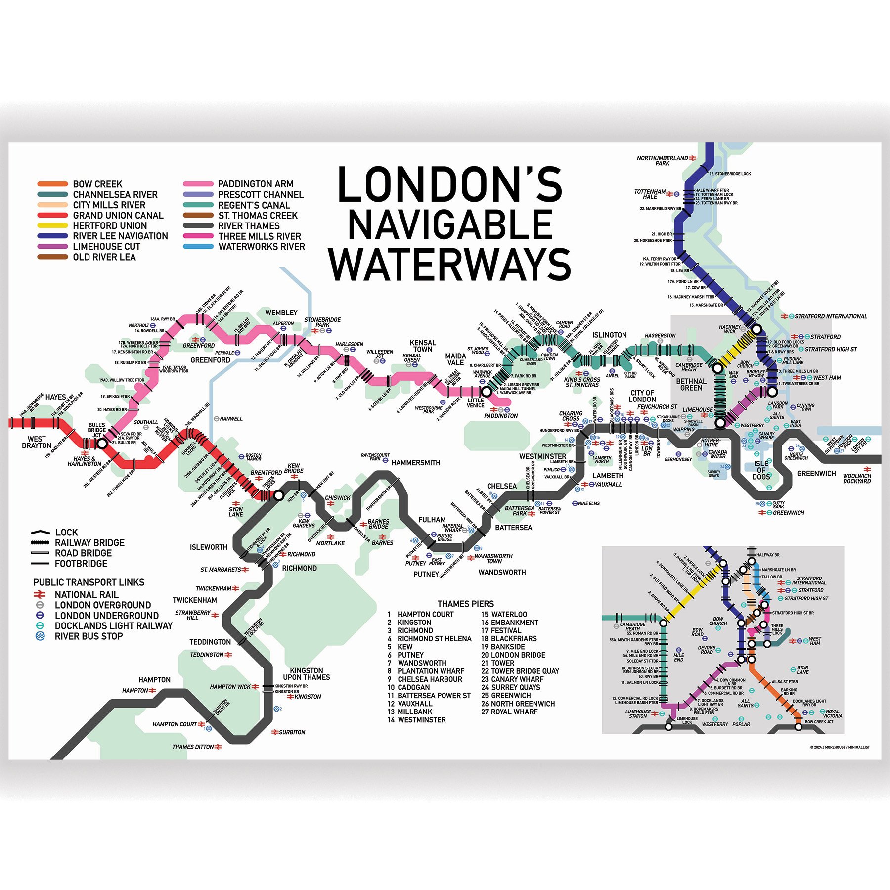
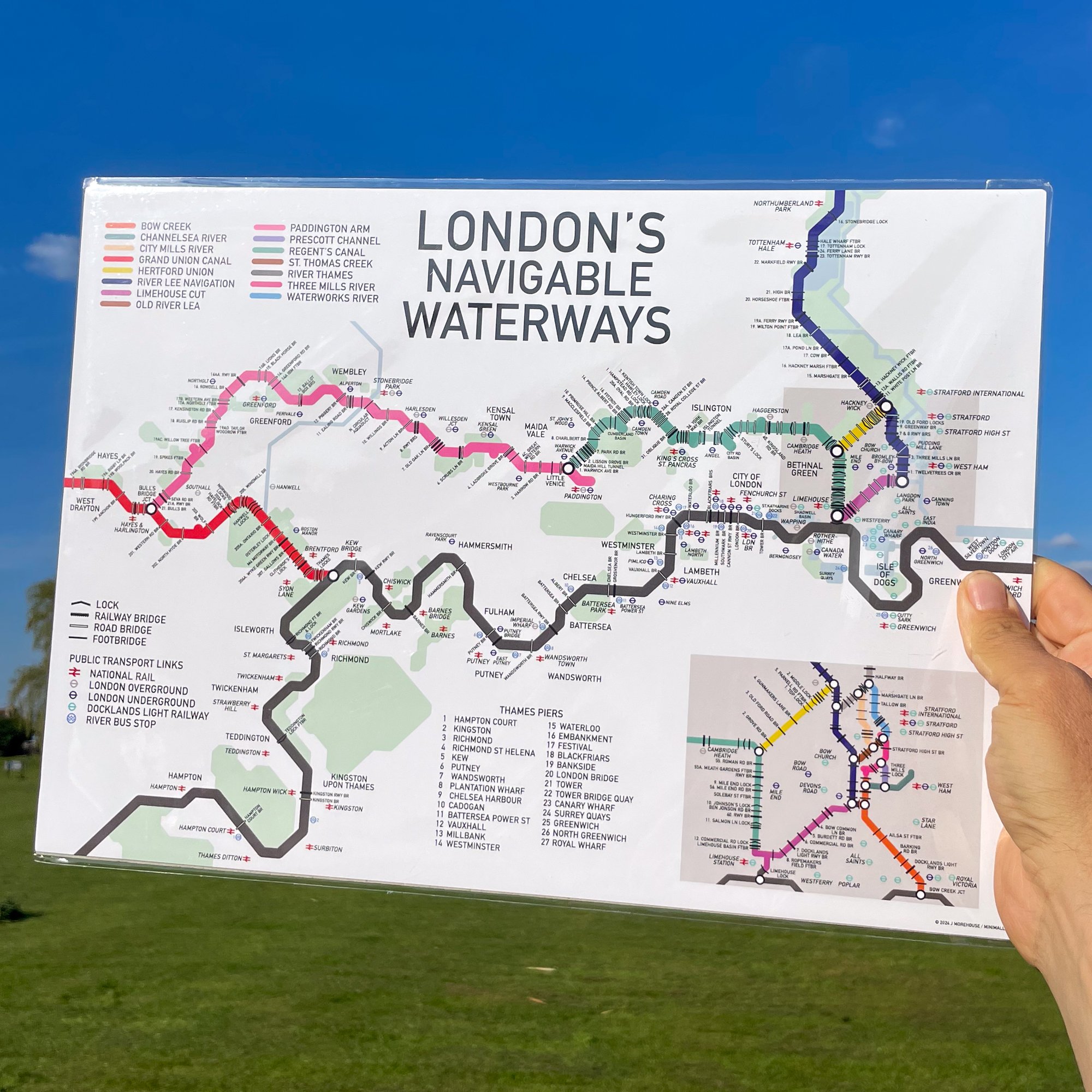
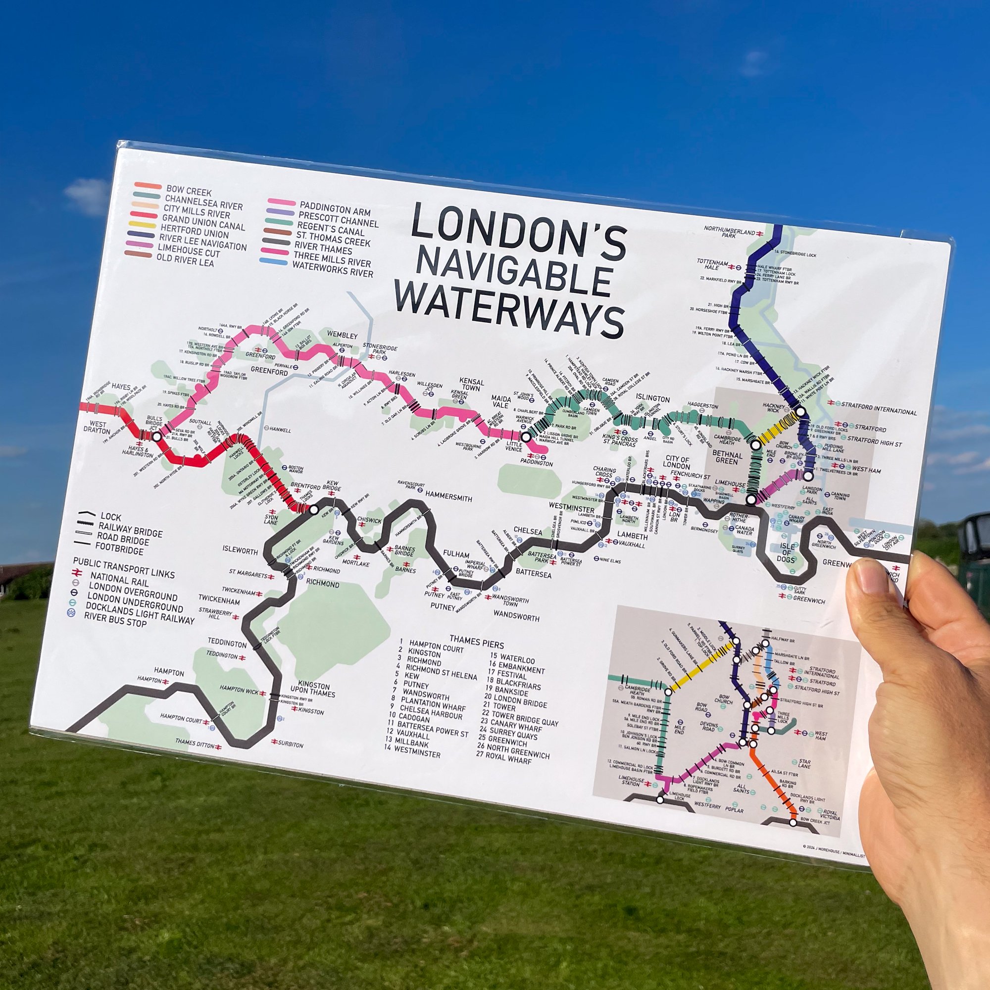
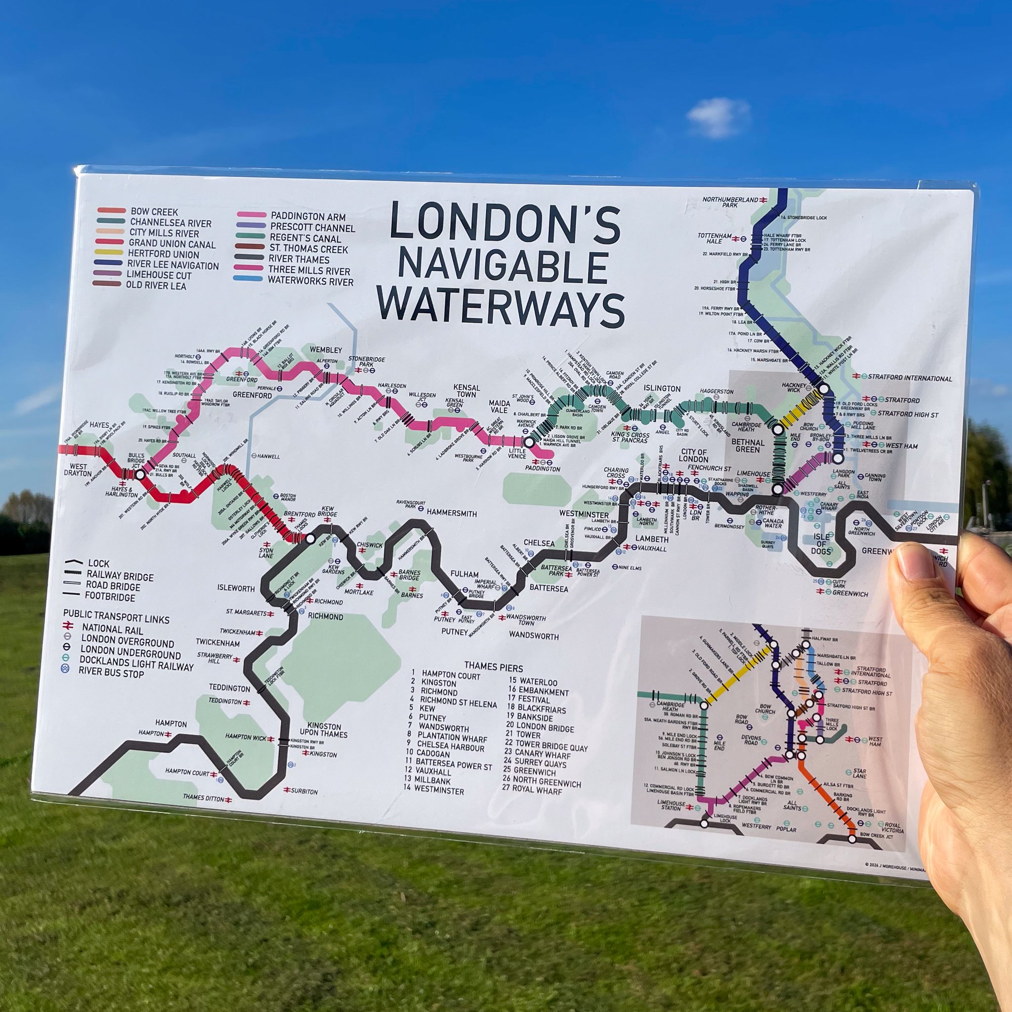
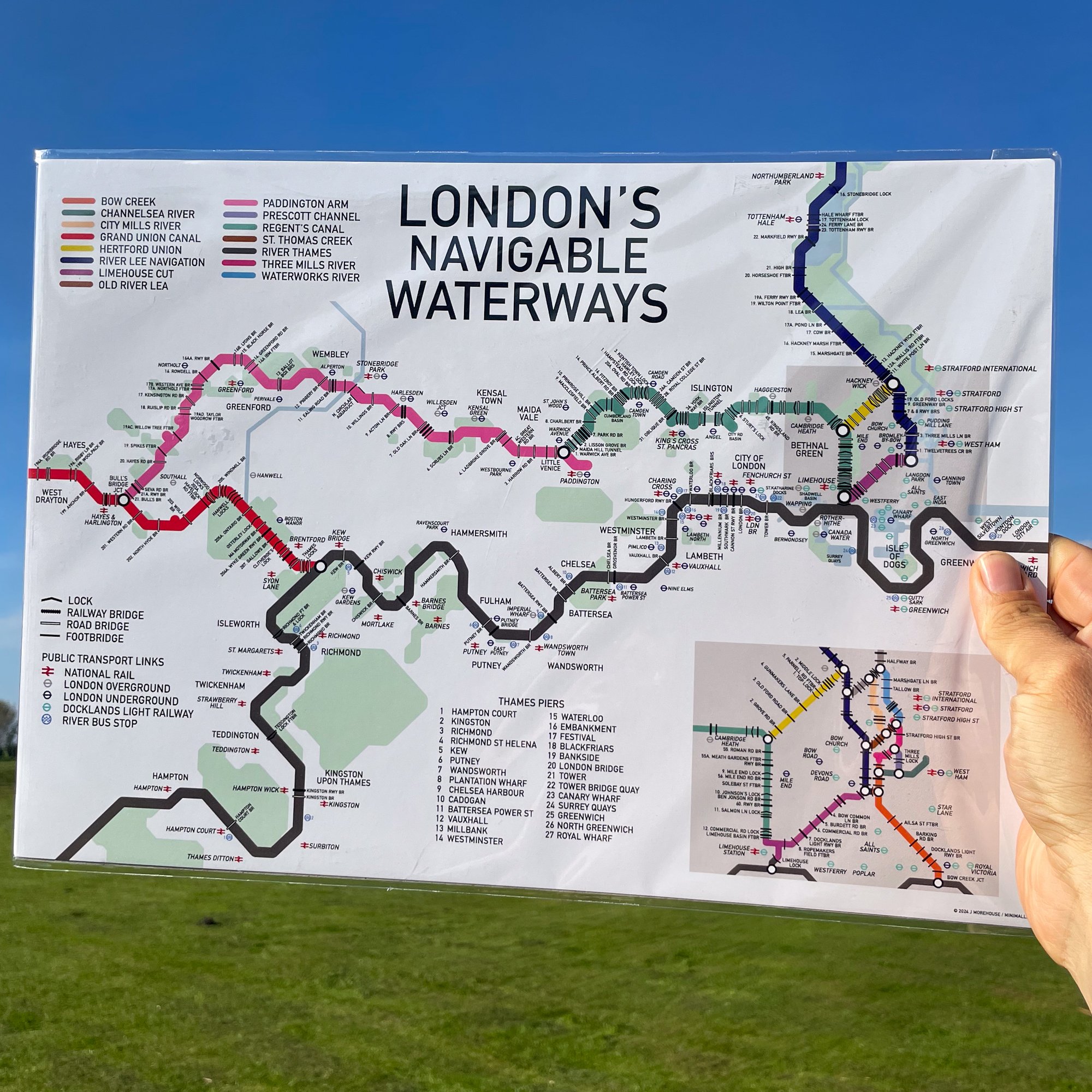
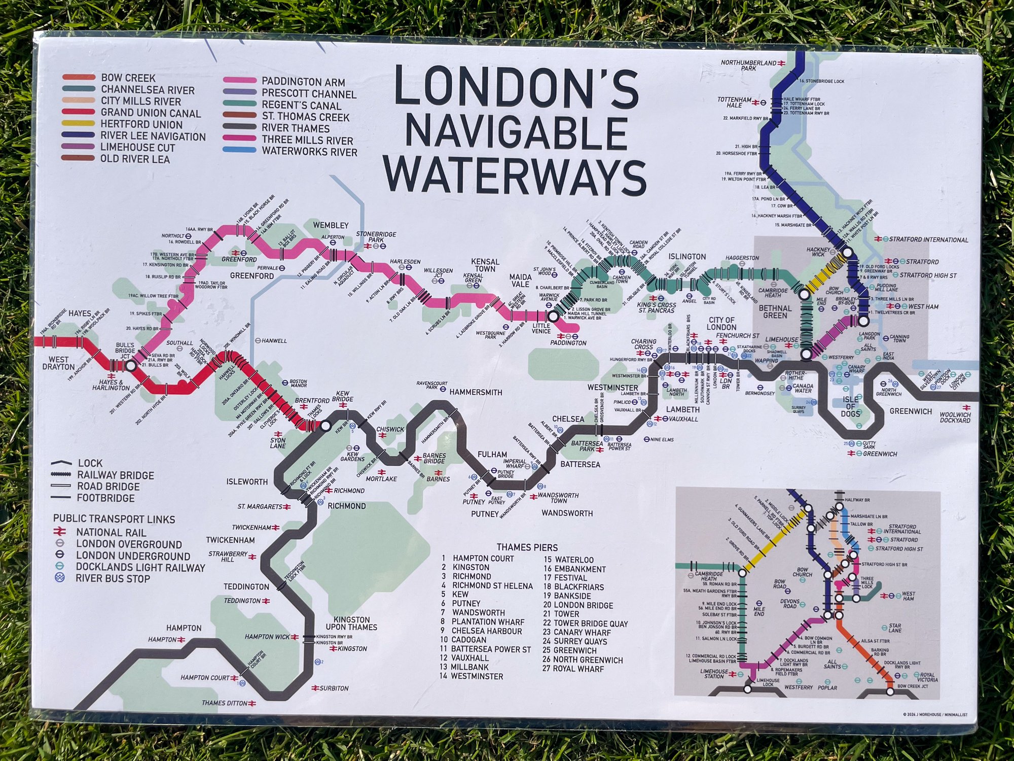
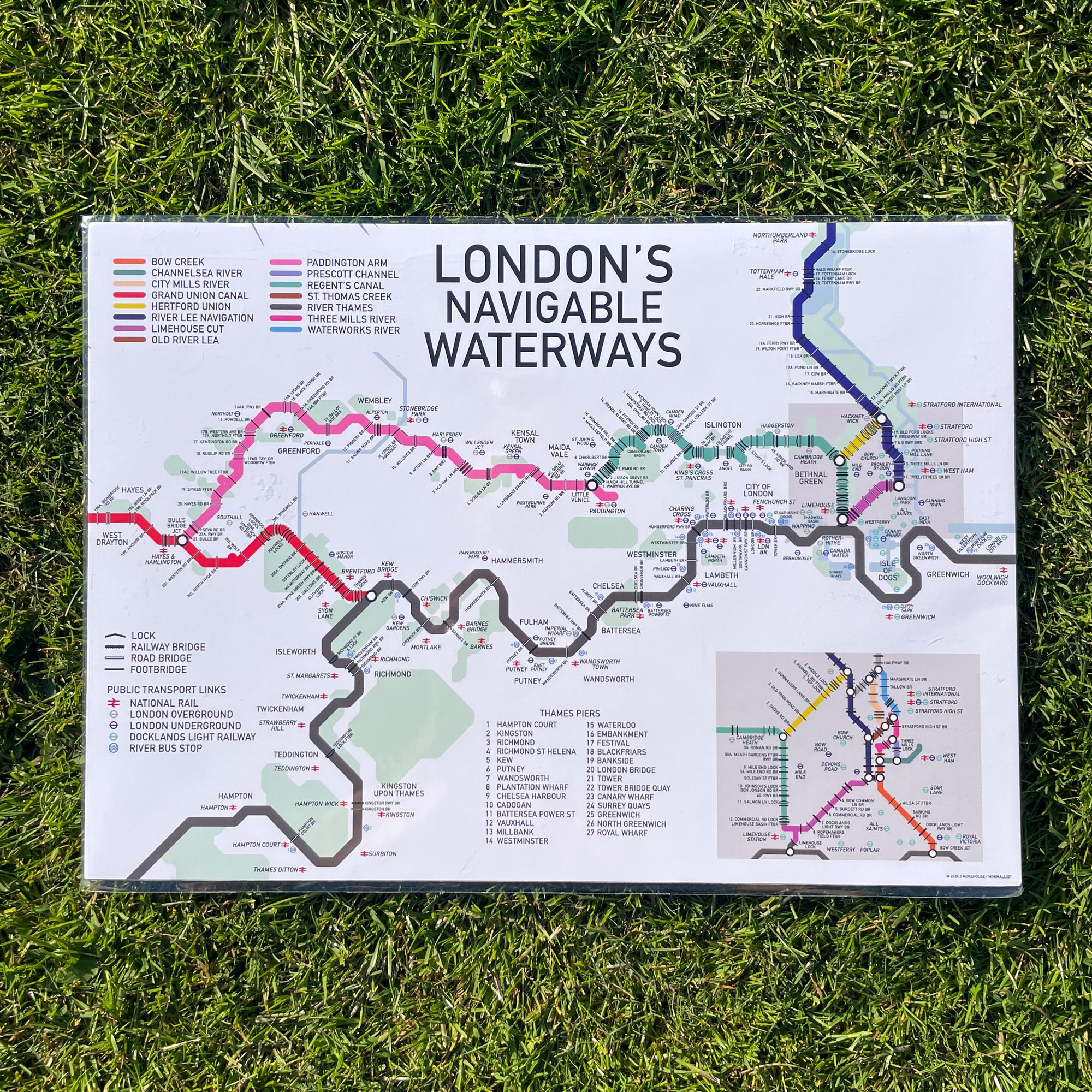

Detailed London Waterways Map - A3
This Inland Waterways Map in a landscape orientation shows the navigable waterways of London and the surrounding area
The map is a colour coded Tube-style guide to the the River Thames, Regents’s Canal, Paddington Arm, the Grand Union Canal and the Bow Back Rivers
The Map is marked with place location names for reference and there is a key on the left panel of the print listing each waterway by name.
There are zoomed in sections for the East London Waterways to show all these navigations in more details.
The map shows all the Locks and Bridges that cross the navigations as well as the location of underground, overground and DLR stations in close proximity to the water. The Thames River Bus piers are also shown.
This map does not include any disused waterways or those currently under restoration.
Print size - A3 - 420 x 297 mm
The print is wrapped in cellophane with a rigid board for protection. It is delivered flat in a brown envelope marked “Please do not bend”. It is packed by hand by us and dispatched from our Narrowboat home in the UK