

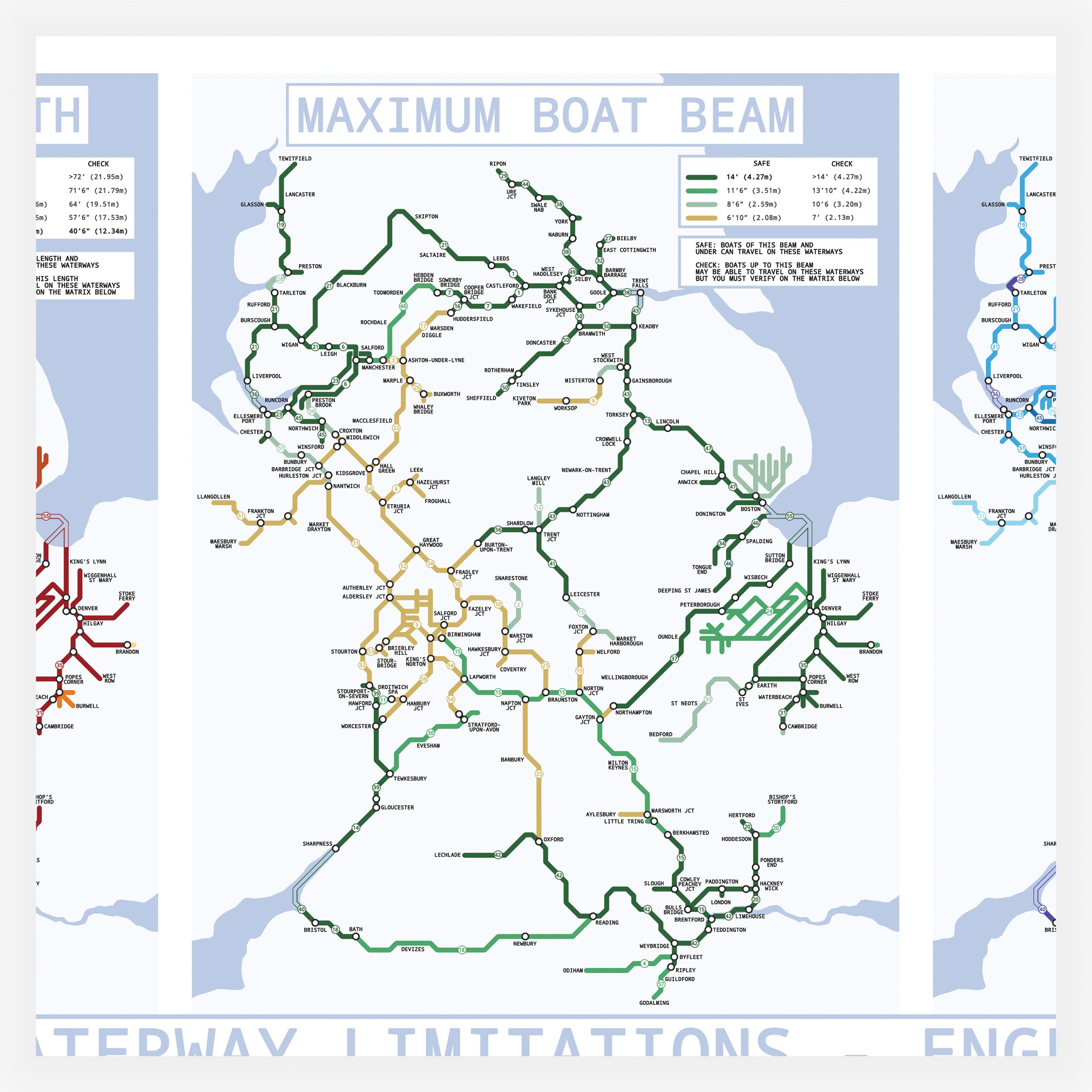

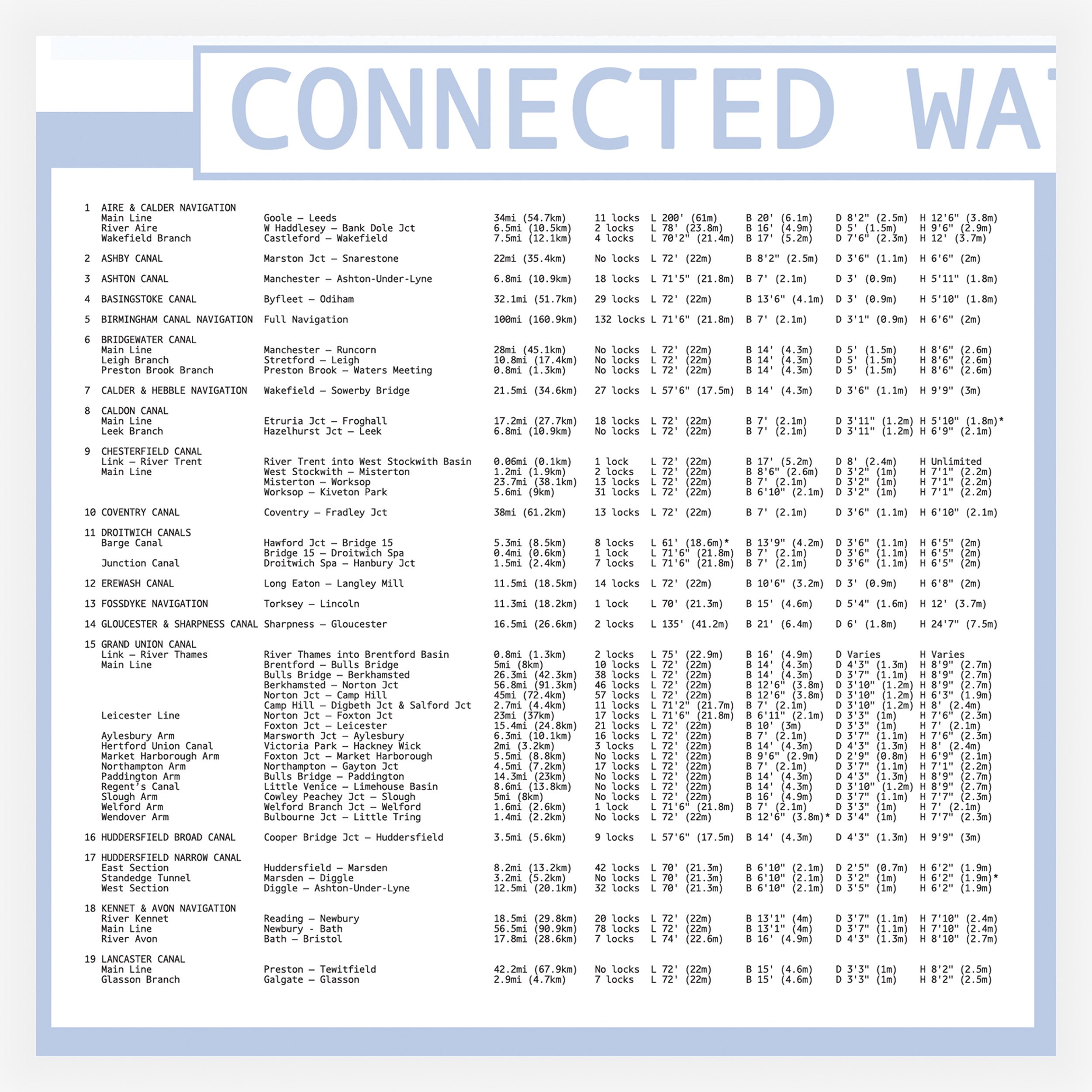
Waterways of England and Wales - Navigation Limitations Map - A1/A2 Size
I am very excited to release my newest map print This was a huge project.
The print includes three maps on the same poster..
The map on the left hand side shows the navigation limits of the integrated waterways of England and Wales by boat Length
The middle map shows the navigation limits of the integrated waterways of England and Wales by boat beam.
-The map on the right hand side shows whether each waterway is a narrow canal, wide canal, river (including navigations with river sections) or a tidal river.
Each map has a key showing what the different colours represent.
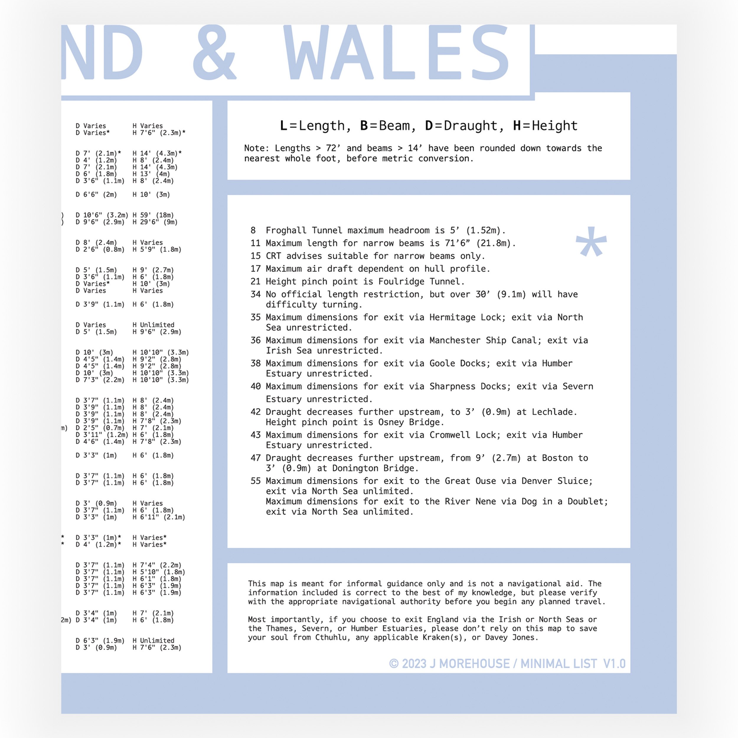
The text below the maps shows the name of the waterway, the location of the beginning and the end of the waterway, the length of the waterway, the number of locks on the waterway, and the maximum boat dimensions that can use each waterway in boat length, beam, draft and height.
The information is listed in boat metric and imperial.
Each waterway is numbered so it can be found on the map and in the key.
The map does show the approximate layout of the waterways, but it is not to scale and the print is not intended to be used as a navigation tool.
Print size options:
A1 - 841 x 593 mm 170gsm
A2 - 594 x 420 mm 250gsm