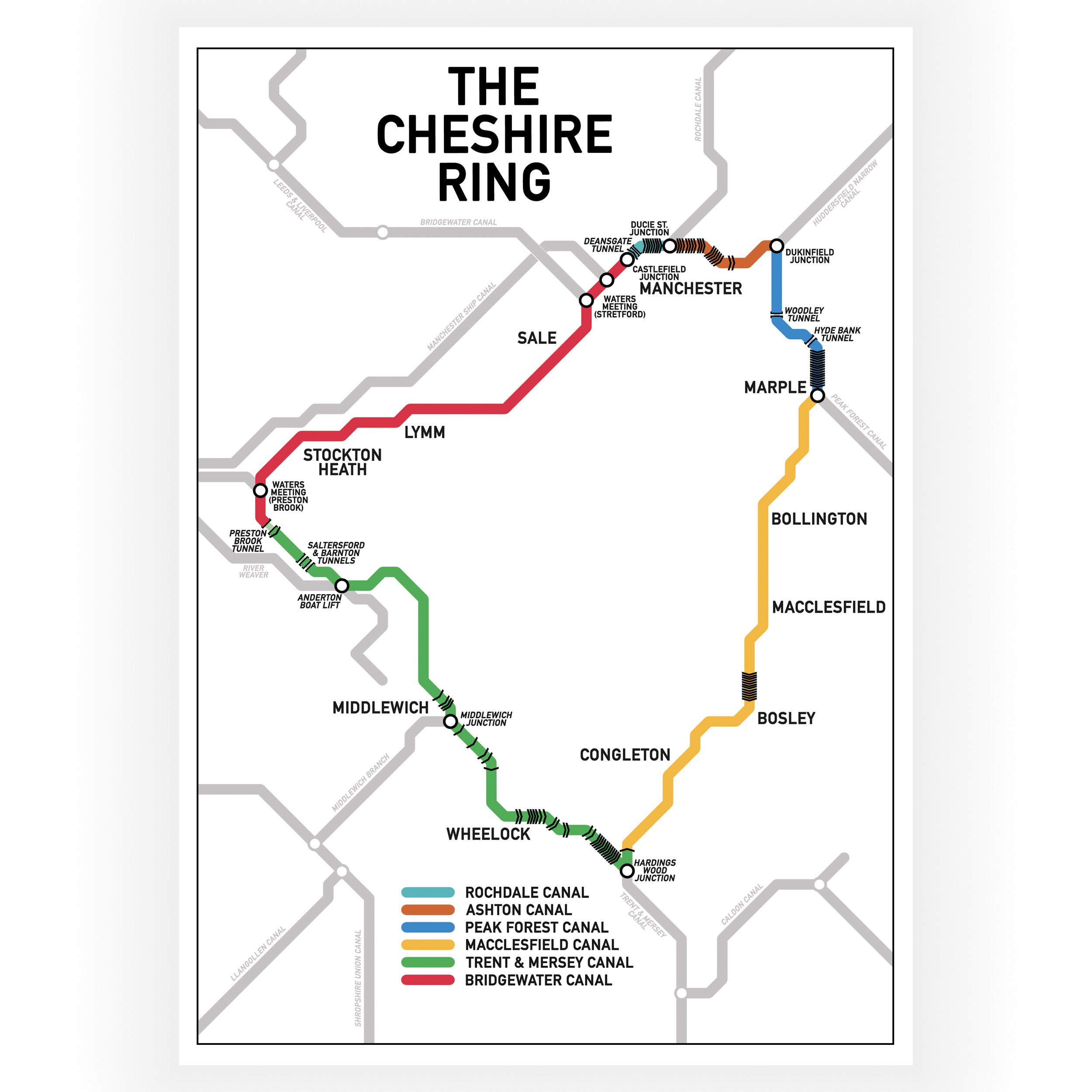


South Pennine Ring Map
This print is a colour coded Tube-style illustration of the popular South Pennine Cruising Ring.
The South Pennine cruising ring is pretty challenging due to the number of locks involved and the fact that you cross the pennines twice, once on the Huddersfield Narrow Canal and once on the Rochdale Canal. This trip makes for a fantastic holiday but you will probably need at least two weeks to complete is and some extra crew would also a very handy. The views are well worth the hard work and you also get a fascinating cruise through the famous Standedge Tunnel
A colour coded key that shows the name of the waterways in the cruising ring has been included in the design. The print also shows the location of the locks, tunnels and the names of the major cities, towns and villages along the route. The map does show the approximate layout of the waterways, but it is not to scale and the print is not intended to be used as a navigation tool.
Print size - A4 - 297 x 210 mm
The print is wrapped in cellophane with a rigid board for protection. It is delivered flat in a brown envelope marked “Please do not bend”. It is packed by hand by us and dispatched from our Narrowboat home in the UK