


Birmingham Canal Navigations Map - A4
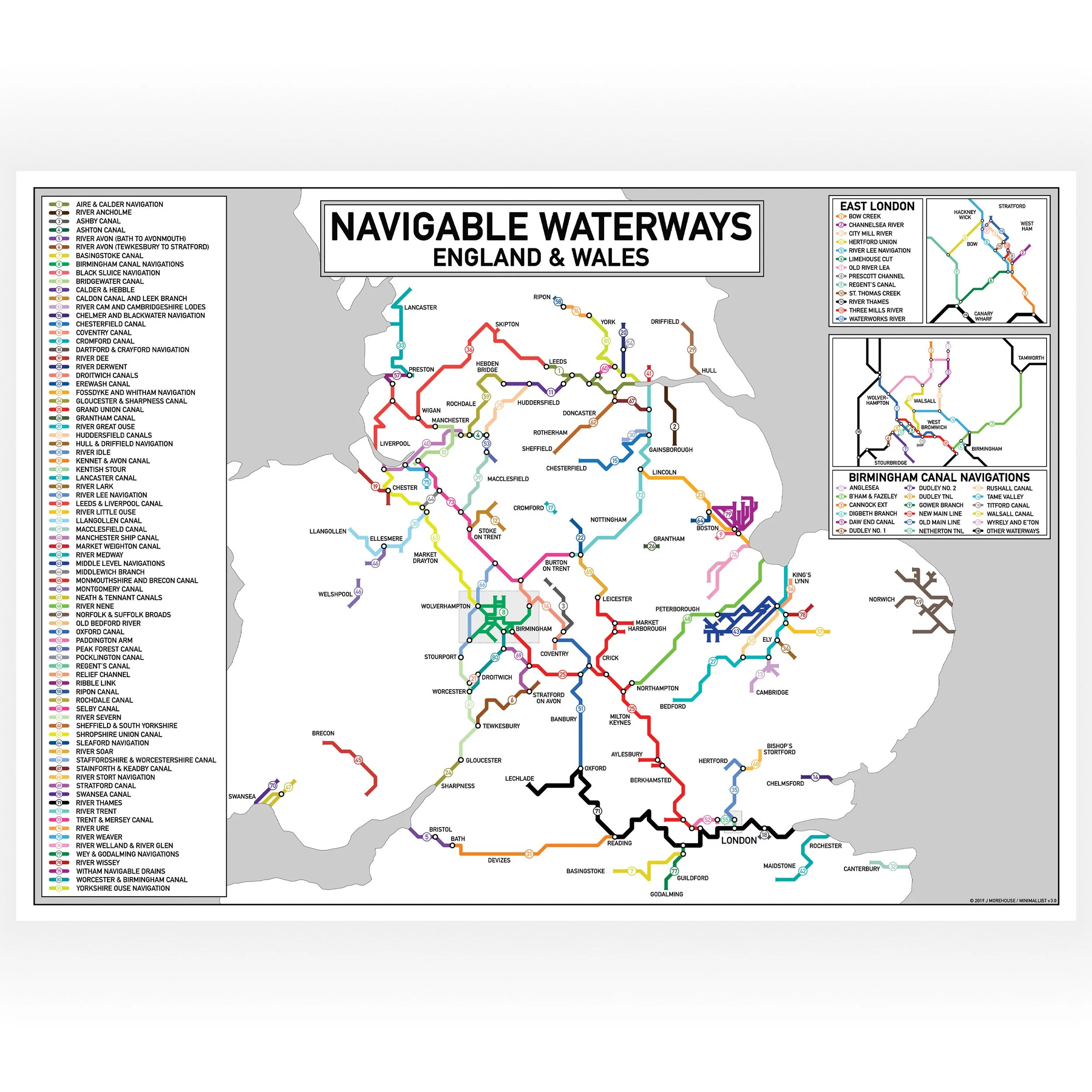
This print is a colour coded Tube-style illustration of the main waterways that make up the Birmingham Canal Navigations. A key that shows the name of each waterway has been included in the design. The print shows the location and names of all locks and tunnels on the BCN, and while it does show the approximate layout of the waterways it is not to scale. The print is not intended as a navigation tool.
The idea for creating a Tube-style map of the Birmingham Canal Navigations first occurred to Jo when she was trying to plan her own cruising route through Birmingham. She couldn’t find a simple map which clearly showed all the different waterways of the BCN and how they connected together and so she decided to make one herself. The map design went through several iterations before she finalised on this version which is now available for purchase as a print.This print only includes waterways that are currently navigable. The BCN has a long and fascinating history. Many of its waterways have been lost to development, are disused or are currently under restoration. These unnavigable waterways have not been included in the design.
Print size - A4 - 297 x 210 mmThe print is wrapped in cellophane with a rigid board for protection. It is delivered flat in a brown envelope marked “Please do not bend”. It is packed by hand by us and dispatched from our Narrowboat home in the UK
- Size: A4