
Navigations of England & Wales - A2
I am very excited to release my newest map print!
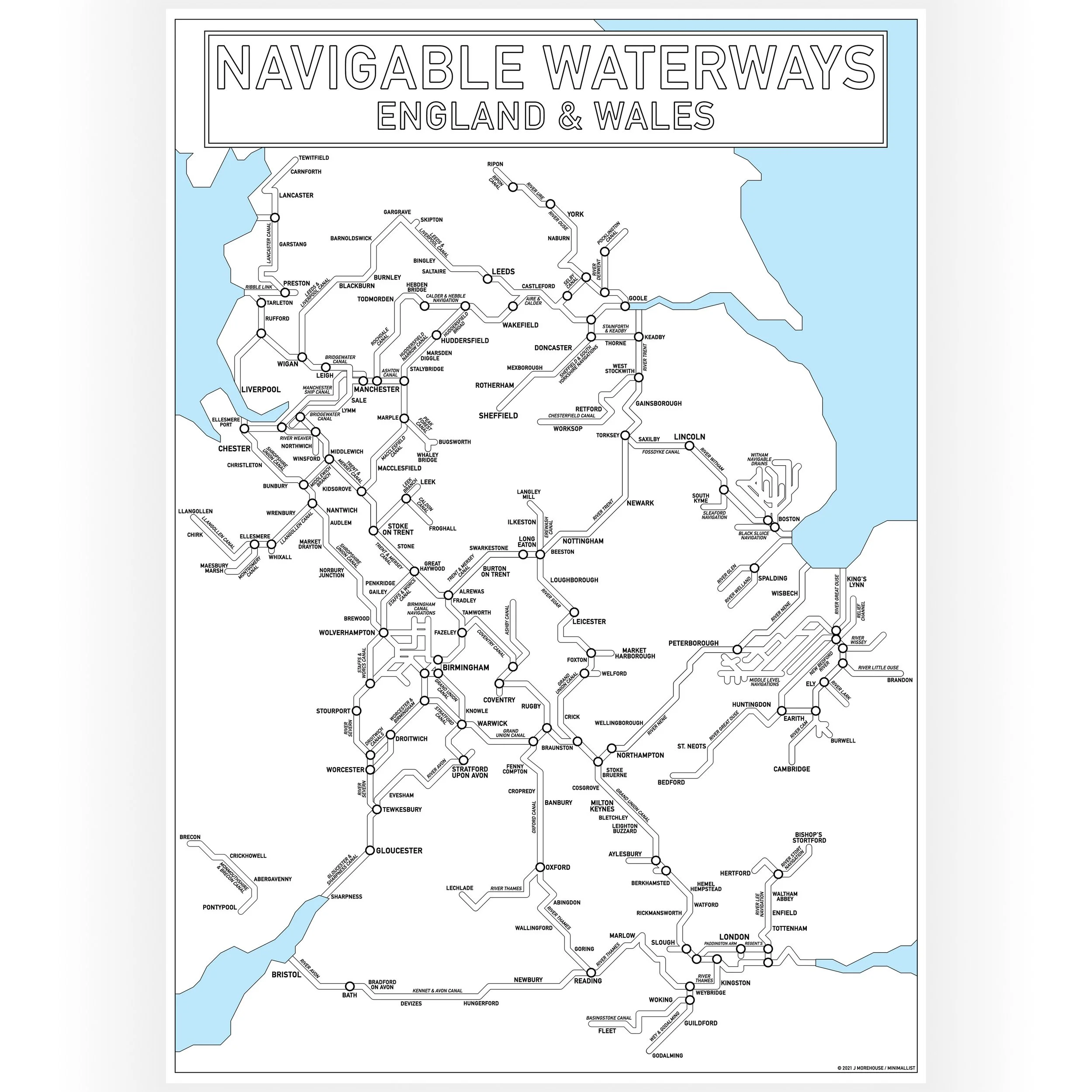
This Inland Waterways Map in a landscape orientation shows the navigable waterways of England and Wales.
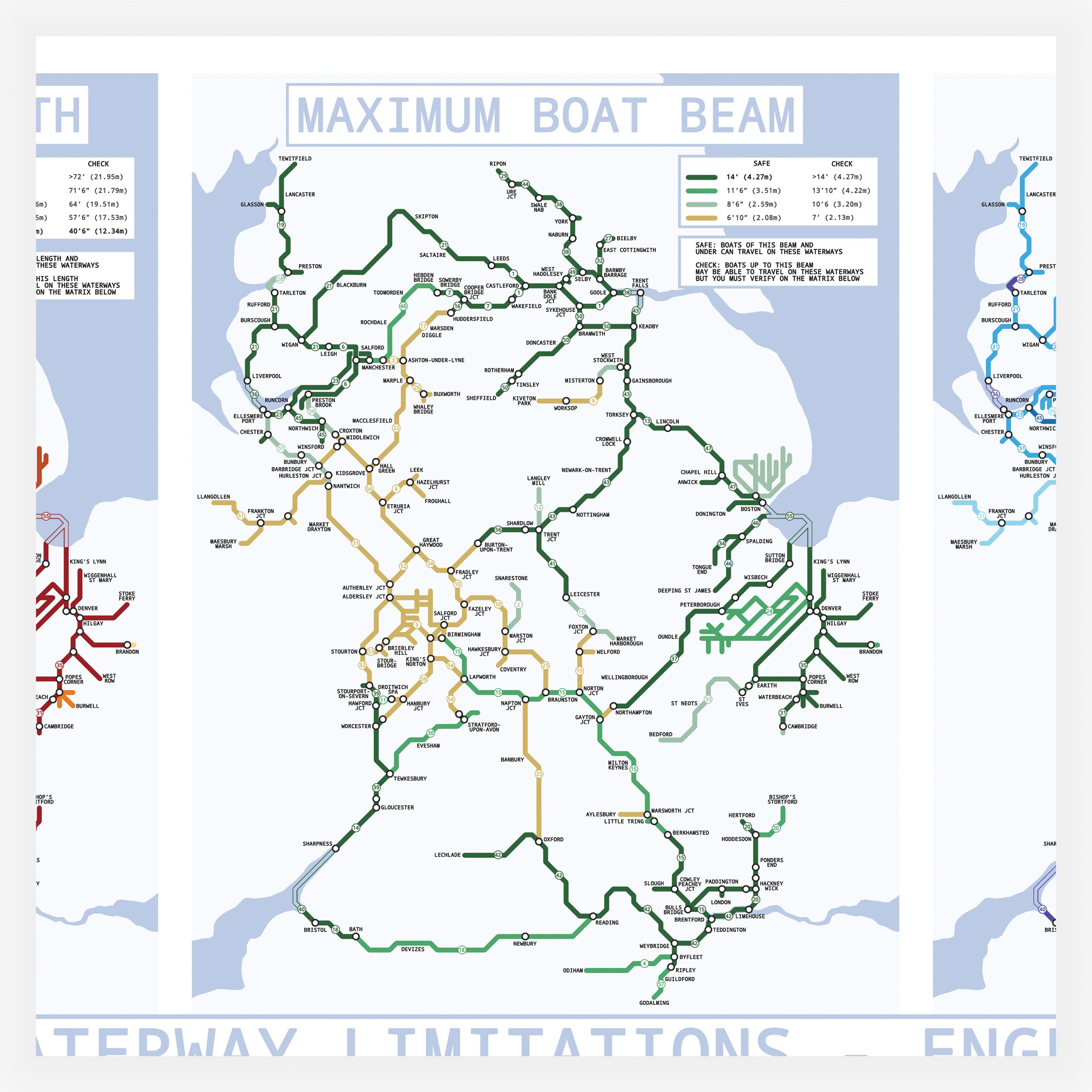
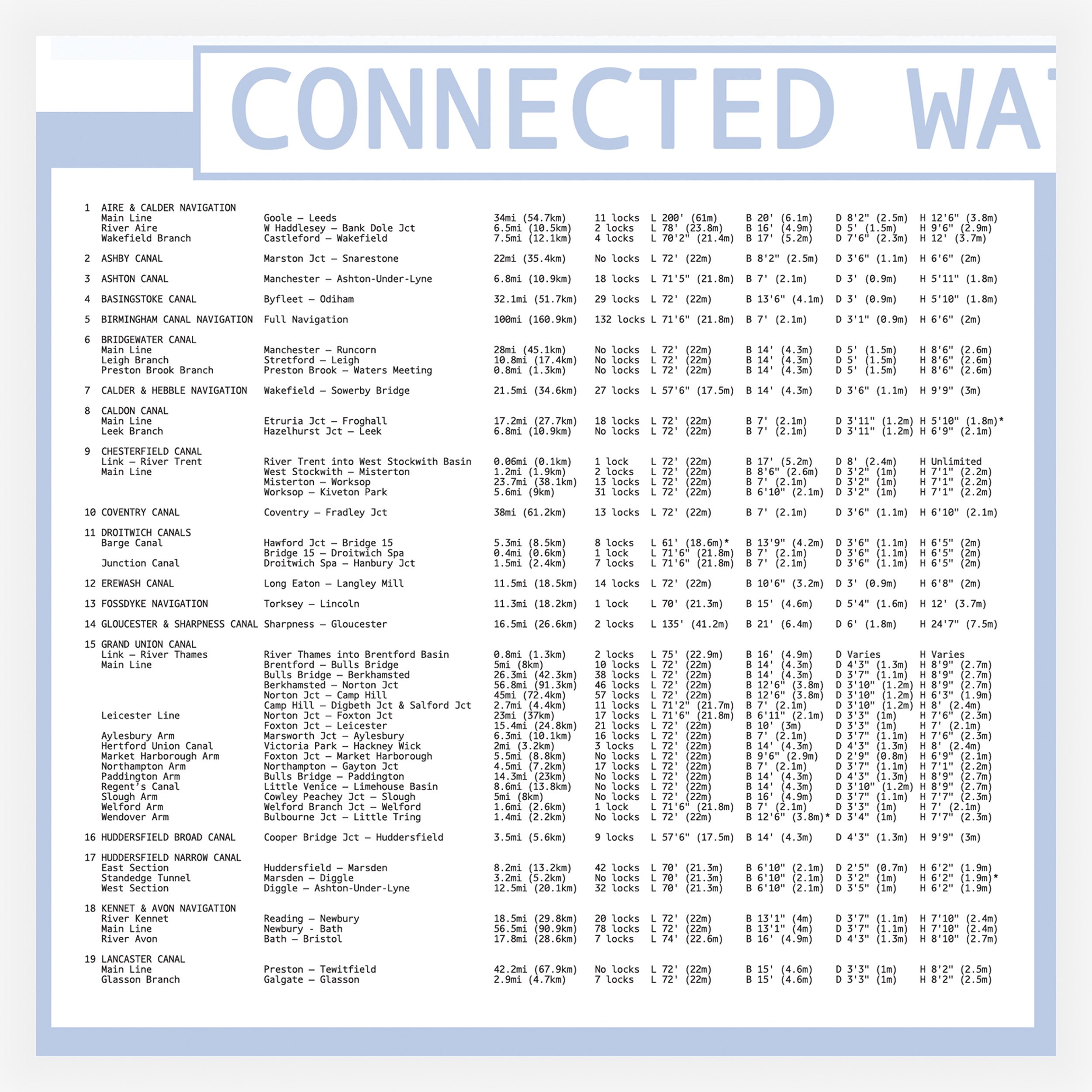
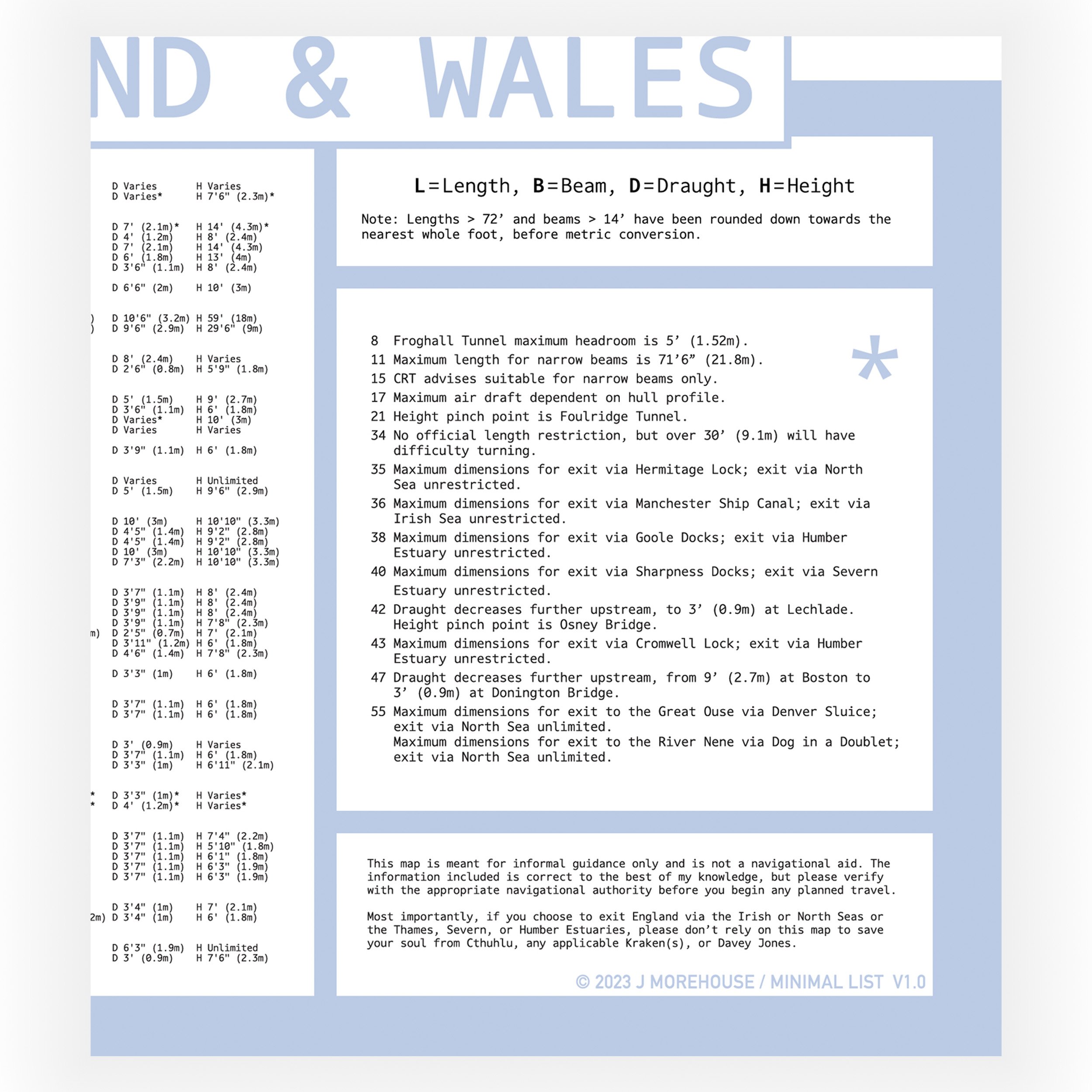
For the first time I have made an A2 sized Waterways Map an it includes the location of every lock on the system as well as all tunnels over 250 meters long.
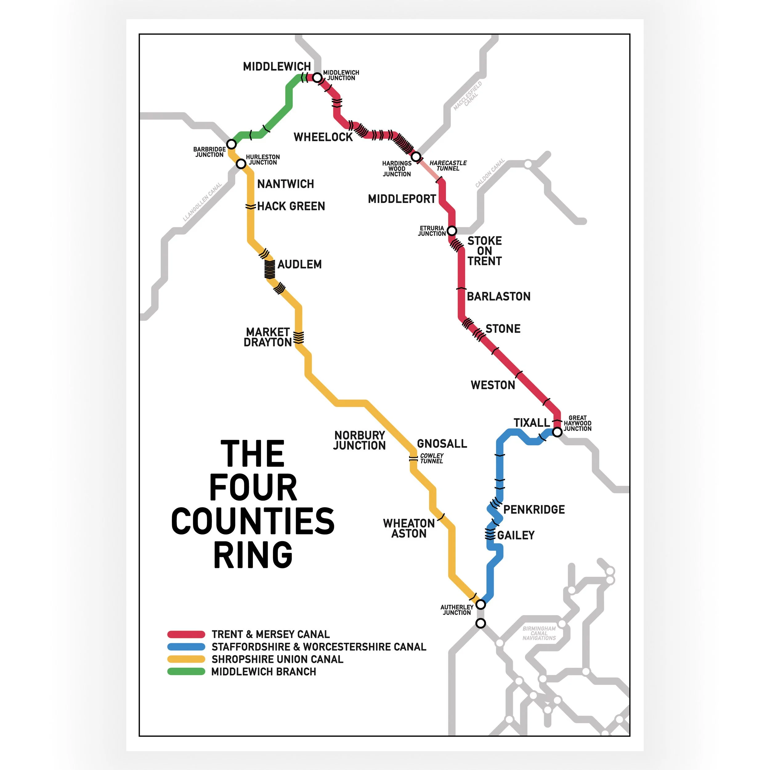
The map is a colour coded Tube-style guide to the UK inland waterways and highlights 114 named navigable waterways.
There are zoomed in sections for the Birmingham Canal Network, The navigable waterways of East London, The Witham Navigable Drains, The Norfolk Broads and The Middle Level Navigation.
This map does not include any disused waterways or those currently under restoration.
Each waterway is numbered so it can be found on the map and in the key.
The map does show the approximate layout of the waterways, but it is not to scale and the print is not intended to be used as a navigation tool.
Print size options:
A2 - 594 x 420 mm 200gsm
The map will be sent in a postal tube which has been packed by hand by us and dispatched from our Narrowboat home in the UK