


Waterways of the Fenlands Map - A4
This print is a colour coded Tube-style illustration the Waterways of the Fenlands including the River Nene, The Middle Level Navigations and the River Ouse and its Tributaries.
We traveled extensively on the waterways of the Fenlands in 2021 and it is honestly one of our favourite parts of the network, so much so that we now get to call it home.
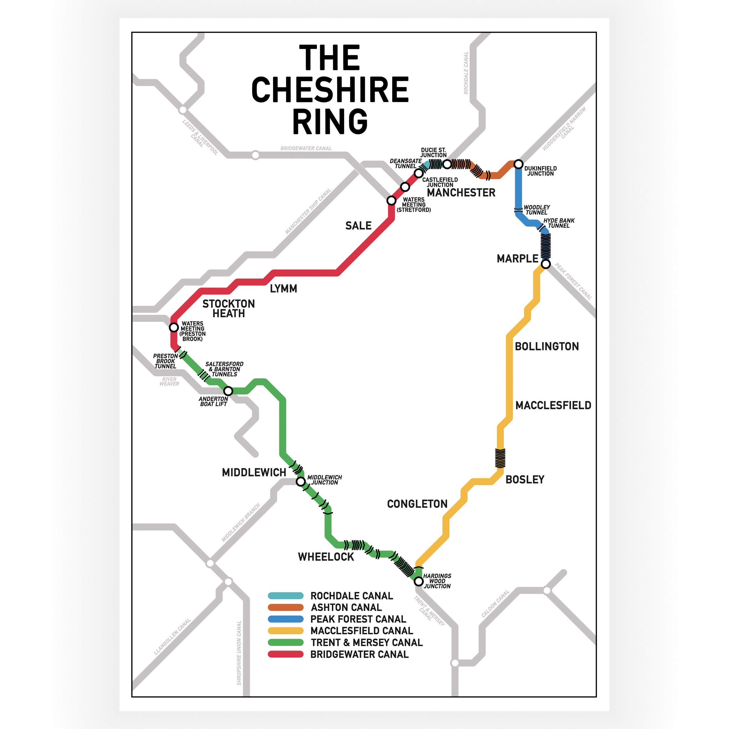
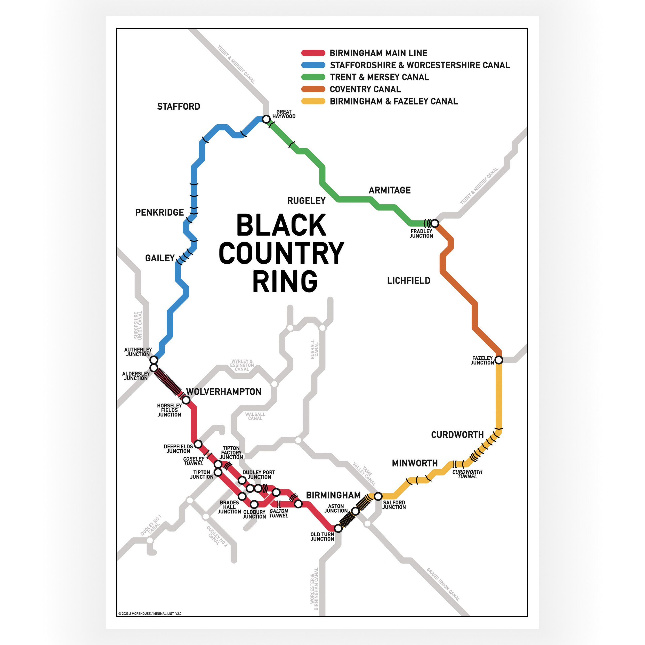
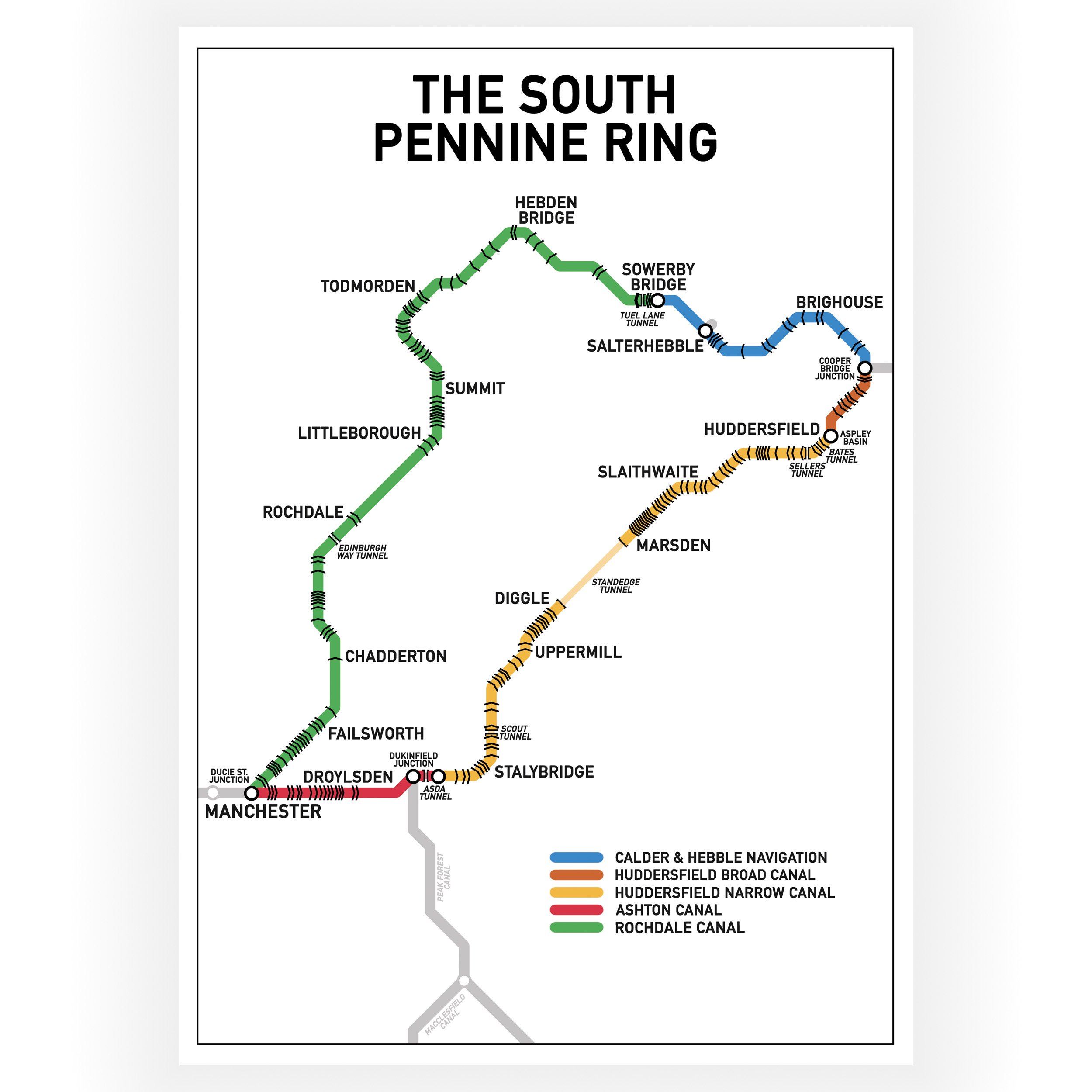
A colour coded key that shows the name of each waterway has been included in the design. The print shows the location and names of all locks, and while it does show the approximate layout of the waterways it is not to scale.
The print is not intended as a navigation tool.
This print only includes waterways that are currently navigable.
Print size - A4 - 297 x 210 mm
The print is wrapped in cellophane with a rigid board for protection. It is delivered flat in a brown envelope marked “Please do not bend”. It is packed by hand by us and dispatched from our Narrowboat home in the UK